
While most Americans would consider the CIA, and perhaps the NSA, household names, one U.S. spy agency — whose headquarters surpasses the U.S. Capitol in size — has managed to keep to the shadows while possessing cutting edge tools of the surveillance trade.
Called the National Geospatial-Intelligence Agency (NGA), even former President Barack Obama didn’t know of its existence when he first took office — despite that the agency employs some 15,400 people.
“So, what do you [do]?” Obama asked a customer at a Washington, D.C., Five Guys hamburgers in May 2009.
“I work at NGA, National Geospatial-Intelligence Agency,” he answered.
“Outstanding,” then-president Obama asserted. “How long have you been doing that?”
“Six years.”
“So, explain to me exactly what this National Geospatial …” Obama asked, unable to recall the agency’s full name.
Timidly, the man replied, “Uh, we work with, uh, satellite imagery.”
“Obama appeared dumbfounded,” Foreign Policy’s James Bamford reports. “Eight years after that videotape aired, the NGA remains by far the most shadowy member of the Big Five spy agencies, which include the CIA and the National Security Agency.”
The NGA’s secretive identity belies the agency’s massive physical size and the scope of its surveillance activities, as Bamford continues,
Completed in 2011 at a cost of $1.4 billion, the main building measures four football fields long and covers as much ground as two aircraft carriers. In 2016, the agency purchased 99 acres in St. Louis to construct additional buildings at a cost of $1.75 billion to accommodate the growing workforce, with 3,000 employees already in the city.The NGA is to pictures what the NSA is to voices. Its principal function is to analyze the billions of images and miles of video captured by drones in the Middle East and spy satellites circling the globe. But because it has largely kept its ultra-high-resolution cameras pointed away from the United States, according to a variety of studies, the agency has never been involved in domestic spy scandals like its two far more famous siblings, the CIA and the NSA. However, there’s reason to believe that this will change under President Donald Trump.
Originally tasked primarily with cartography — before a mammoth expansion, the spy arm had been called the National Imagery and Mapping Agency — until a name and mission switch in 2003 gave the National Geospatial-Intelligence Agency its name, with the hyphen allowing a three-letter acronym so enamored by the government.
President Dwight D. Eisenhower, whose fondness for imagery intelligence became known when he served as a general during World War II, created the National Photographic Interpretation Center shortly before leaving office — an agency also later absorbed by the NGA.
Now, the NGA works in conjunction with the U.S. Air Force to analyze the staggering amount of data collected through aerial surveillance abroad — mostly by unmanned aerial systems, such as drones with high-powered cameras.
According to at least one source, as of 2013, the NGA was integral in the analysis of surveillance data pertaining to Iran’s nuclear capabilities.
Revelations on the depth and breadth of the Central Intelligence Agency’s domestic capabilities, long believed out of its territory, was exposed by WikiLeaks Vault 7 recently to be on par with National Security Agency programs — so much so, analysts say it constitutes a duplicate Big Brother.
Data provided to the NGA by military officials has assisted in various U.S. operations in the Middle East by tracking vehicles believed responsible for planting improvised explosive devices, or IEDs, and for monitoring hot spots for insurgent breakouts.
But the NGA hardly only keeps to support operations, as David Brown — author of the book, Deep State: Inside the Government Secrecy Industry — explained,
Before the trigger was pulled on NEPTUNE’S SPEAR, the mission to kill Osama Bin Laden, SEAL Team Six had access to a perfect replica of the Abbottabad compound where the terrorist mastermind was hiding. The details for the replica were gathered by the NGA, which used laser radar and imagery to construct a 3D rendering of the compound. How precise were its measurements and analysis? The NGA figured out how many people lived at the compound, their gender, and even their heights. But the NGA didn’t stop there: Its calculations also helped the pilots of the stealth Black Hawks know precisely where to land.
 With a combined budget request for 2017 of $70.3 billion, the National and Military Intelligence Programs — NGA falls under the latter — have seen a quickening of support from the authoritarian-leaning, pro-military Trump administration. This and additional factors — such as the astonishingly sophisticated equipment at the agency’s disposal — have ignited fears the NGA could be granted authority to bring its expert microscope into focus against the American people.
“While most of the technological capacities are classified, an anonymous NGA analyst told media the agency can determine the structure of buildings and objects from a distance, has some of the most sophisticated facial recognition software on the planet and uses sensors on satellites and drones that can see through thick clouds for ‘all-weather’ imagery analysis,” reports news.com.au.
Efforts to bolster NGA’s innovate staff pool ratcheted up on Thursday, as Business Wire reported,
From navigating a U.S. aircraft to making national policy decisions, to responding to natural disasters: today’s U.S. armed forces rely on Geospatial Intelligence (GEOINT) to meet mission requirements. As the nation’s primary source of GEOINT for the Department of Defense and the U.S. Intelligence Community, the National Geospatial-Intelligence Agency (NGA) depends on the National Geospatial-Intelligence College (NGC) to produce top-tier talent to deliver intelligence with a decisive advantage. Today, Booz Allen Hamilton (BAH) announced that it has been awarded a five-year, $86 million contract by NGA-NGC to lead the Learning Management and Advancement Program (LMAP) that will provide high-quality learning solutions to equip a diverse workforce with the knowledge and skills necessary to meet current and future GEOINT mission requirements.
Bamford points out for Foreign Policy that the Trump administration intimated a significant expansion of spying on mosques and Islamic centers, while others admonish said surveillance could put Black Lives Matter and other protest groups in the NGA’s silent crosshairs.
RFID Scan Blockers – Available for Free (Ad)
Of distinct concern for privacy advocates are drones with uncanny zooming capabilities — features used against U.S. citizens before. Bamford continues,
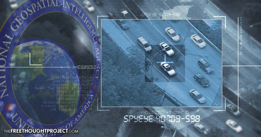
In 2016, unbeknownst to many city officials, police in Baltimore began conducting persistent aerial surveillance using a system developed for military use in Iraq. Few civilians have any idea how advanced these military eye-in-the-sky drones have become. Among them is ARGUS-IS, the world’s highest-resolution camera with 1.8 billion pixels. Invisible from the ground at nearly four miles in the air, it uses a technology known as ‘persistent stare’ — the equivalent of 100 Predator drones peering down at a medium-size city at once — to track everything that moves.
With the capability to watch an area of 10 or even 15 square miles at a time, it would take just two drones hovering over Manhattan to continuously observe and follow all outdoor human activity, night and day. It can zoom in on an object as small as a stick of butter on a plate and store up to 1 million terabytes of data a day. That capacity would allow analysts to look back in time over days, weeks, or months. Technology is in the works to enable drones to remain aloft for years at a time.
With cutting-edge technology, a rapid enlargement underway, and billions in budgetary funds at the ready, the National Geospatial-Intelligence Agency is the cloaked, mute sibling of the nefarious Intelligence Community — but it’s time to pull the protective shell off this potential ticking time bomb before reining it in becomes an impossibility.
Claire Bernish writes for TheFreeThoughtProject.com, where this article first appeared.
What IF there is no space. You only believe in SPACE because you was told that space exist. Question everything,believe nothing.
Bored?
This is the kind of information that most Americans prefer to ignore, dismiss and not care about. Question Trump, the military or government agencies and you’re the bad guy, the “idiot” or you’re wearing the proverbial “tin foil hat.” Either that or you’re a “conspiracy theorist” that believes anything you see on the net. Most people don’t want facts and information. They’re comfortable with their 9-5 and have no interest in asking questions or critical thinking because the mainstream media, religion and politicians are always 100% correct and we should have no nerve to question any of that.
“Sometimes paranoia’s just having all the facts.”
— William S. Burroughs
Sadly you are so correct. Most Americans have a terminal case of “anusnitis” (my word)
They can do better than a stick of butter. How about reading the date off a coin? That’s possible too.
If they can admit to the stick of butter, it is reasonable to assume higher capabilities just as the listed capabilities of fighter aircraft only hint at their actual performance.
It’s bullshit, such resolution is impossible from orbit even with stereoscopic imaging from two satellites.
There is always someone who claims to know more than everyone else, I’m sure you don’t.
Well, please, go ahead and tell us what mirror size is required to resolve 8cm/4″ per pixel from a stable orbit? that is, 160km altitude minimum.
That’s hogwash, Hogspace! I was an Aerial photo-interpreter during the Vietnam war. With satellite imagery you could see someone smoking a cigarette. That was 45 years ago, so I would expect they can tell you what brand of cigarette it is now.
Are you confusing aerial and satellite imaging. The highest performance available from a satellite in a stable orbit is currently 30cm per pixel.
You could get superior results but only in a rapidly decaying low earth orbit. Perhaps the military has recoverable imaging pods?
Able to see a stick of butter from space but the only country without universal health care & elderly will not get the SS & medicare benefits they worked 40 years to have. Food ,clothes & housing have gone up 50% in last 5 years but because they keep the gas prices down there is no COLA.
I just wanna know if it’s sweet or salted. Why do they even sell salted butter? Any putz can toss in a pinch of the salt of their choice. I like Pink Himalayan.
This is about “Activity Based Intelligence” or “Human Domain Analytics” and it is the cutting edge in intelligence. It is what Jade Helm was really about. Basically, they use Big Data to know everything there is to know about us to optimally control us. See “Investigative Report: Jade Helm Mystery Solved” or “Master the Human Domain: The Domestic Plan Behind Jade Helm” both on Infowars dot com for more details.
You want to see what they can do looking down from space?? Go to Google Maps, zero in on an address in the US and start clicking the plus sign there to get closer and closer in a birds-eye-view of that address you chose. Of course you can’t get real close like these govt spy agencies can. I’m not sure of exactly how far above the target you and I can get though I’d guess around a half mile away – probably further. I found my aunt & uncles place and I could see two white cars out front and I could see three humans on their deck but I couldn’t tell who that was. But that’s pretty impressive all by itself. While you run out of clicks to get closer and it’s not real sharp, the govt analysts do not and can zoom in to almost unimaginable closeness and sharpness. Years ago the very first spy satellites could (remember these?) “read the words on a newspaper” or “zero in on a golf ball almost anywhere on the golf course” and that was many years ago now. So like I said the normal everyday Joe probably can’t imagine the capabilities the govt has to spy on people these days. Let’s hope they’re watching all the foreign govts they’re supposed to be…”monitoring” instead of spying on Americans in America. And IF they are, somebody needs to go to jail for a long time because of that.
Can they read the brand name on the golf ball, I wonder? That’s a good test of technology’s present state. How about it, guys? Is it a 1909-S VDB penny I’ll be holding up at 1:08 pm tomorrow? You know where I live. I’ll be in front of the shed.
If you had spent just a few moments you would have discovered all of those higher resolution images are from low level camera planes and drones.
Then why won’t they allow one to get a closer view if it’s from an everyday airplane?? Those are from the commercial European satellite(s) is what I’ve read. I think you’re wrong but go ahead and leave your proof with a link so we can check that out.
You may read about Dawes’ Limit and Angular Resolution and the The Rayleigh criterion. Also suggest how many satellites with mirrors considerably larger than Hubble (2.4m) are in orbit and tell us how they are being held in a low earth orbit of 160km or less without the orbit decaying rapidly. Please also tell us how they were made without the involvement of the global scientific community.
Hint: the only larger mirror made and put into orbit to date was the Herschel telescope and it imaged in the infra-red spectrum, until it was deactivated in 2013.
Further hint: anything of this size in anything like a useful orbit for looking down could be seen and queried by everyone.
The current state of the art mirror development is for the future James Watt Space Telescope due to launch in 2018. It has a folding segmented mirror nearly 3 times the size of the Hubble mirror but it also an Infra Red imaging device and will orbit 1.5 million miles from earth.
Once again, mm or cm resolution of the earth’s surface comes from planes or drones in the atmosphere. At best perhaps a sacrificial satellite that images while plunging low to a fiery death.
Surely a Foreign Government would locate the drones with radar, unless of course they were stealth drones? These drones have been specifically designed for surveillance of their own people.
I saw a pic back in the 70’s you could read the date from a dime and the pic was (allegedly) taken from space(?). I’m leaning toward the dome theory of flat earth, never believed the everything is spinning and gravity is mystical.
These are the sort of surveillance tools which the CIA might use to verify that Michael Hastings got into the car which they planned to hijack and crash. Every capability that you see in the film ENEMY OF THE STATE actually exists, even if it does not look and work exactly as depicted. When Americans allowed the federal income tax and secret agencies with secret budgets, they allowed the nation to be converted from a democratic republic into a covert dictatorship. I call it that because the ignorant masses will never know what was done in secret to keep them enslaved from that point on. This is basically what Eisenhower was warning about in his farewell address; that a high-tech secret government could become the greatest threat to freedom that Americans would ever face. There are good people in these secret agencies but there is no way to prevent abuse of secret technology and secrecy privilege by contractors or employees. As the saying goes, who will watch the watchers.